
Climate scientists are increasingly warning that Earth may be heading toward one of the strongest El Niño events in modern history, a development that could trigger extreme weather, accelerate global warming, and reshape climate patterns well into 2027. A report from The Washington Post says new forecasts and ocean data suggest the developing El Niño could rival or even surpass the powerful events of 1877, 1997-98, and 2015-16, all of which caused major global disruption.
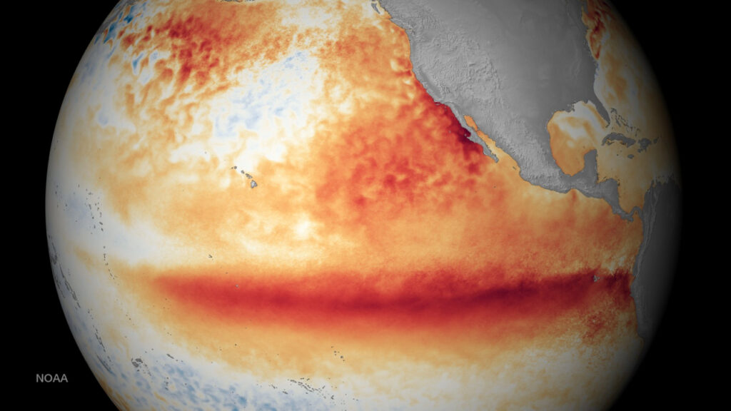
At the center of concern is the rapid warming of the equatorial Pacific Ocean. According to the Post, temperatures in parts of the central Pacific could rise more than 3 degrees Celsius above average later this year, a level associated with what scientists call a “super El Niño.” Forecasters say the odds of El Niño forming between May and July are already high, and confidence has increased because of unusually strong oceanic heat patterns building beneath the surface.
What makes this event especially alarming is the broader climate backdrop. Previous major El Niño events occurred in a cooler world. Today, the planet is already significantly warmer because of greenhouse gas emissions, meaning any powerful El Niño now amplifies temperatures on top of an already elevated baseline. Experts quoted in multiple reports warn that this combination could push global temperatures to new records and increase the chances that 2027 becomes the hottest year ever recorded.
The weather consequences could be enormous and highly uneven across regions. The Washington Post reports that El Niño typically alters jet streams, rainfall patterns, ocean temperatures, and storm systems around the world. In the United States, forecasters expect a greater risk of severe storms along the West Coast, wetter conditions across parts of the South, and warmer winters in northern regions. Other reports suggest Texas and parts of the southern Plains could experience cooler, wetter winters that may bring heavier precipitation and even unusual snowfall.
Globally, the impacts could be even more disruptive. Scientists warn of intensified droughts in some tropical regions, heavier flooding in others, marine heatwaves, agricultural stress, and worsening water shortages. Strong El Niño events can trigger long-lasting “climate regime shifts,” where ecosystems and weather patterns do not fully return to previous conditions even after the event fades. Regions such as East Africa, Southeast Asia, the Amazon, and parts of India are considered particularly vulnerable to persistent changes in rainfall and temperature.
Researchers are also paying close attention because the early signals resemble patterns seen before historic El Niño events. The Post highlighted rare wind bursts across the Pacific and unusually large subsurface heat anomalies moving eastward beneath the ocean surface. Those conditions help transport warm water toward South America and strengthen the atmospheric feedback loops that fuel major El Niño events. Scientists say these signals are some of the clearest warnings yet that a potentially historic climate shift may already be underway.
At the same time, forecasters caution that uncertainty remains. Some climate models still suggest a weaker event or even neutral conditions later in the year. But the growing consensus among meteorologists is that the risks are rising quickly enough to demand attention from governments, emergency planners, agriculture officials, and energy markets.
Ultimately, the concern is not simply about one weather cycle. Scientists increasingly view powerful El Niño events as amplifiers of an already unstable climate system. In a warmer world, a super El Niño may no longer be just a temporary disruption — it could become a force capable of intensifying long-term climate extremes, economic shocks, and environmental stress across the globe.