
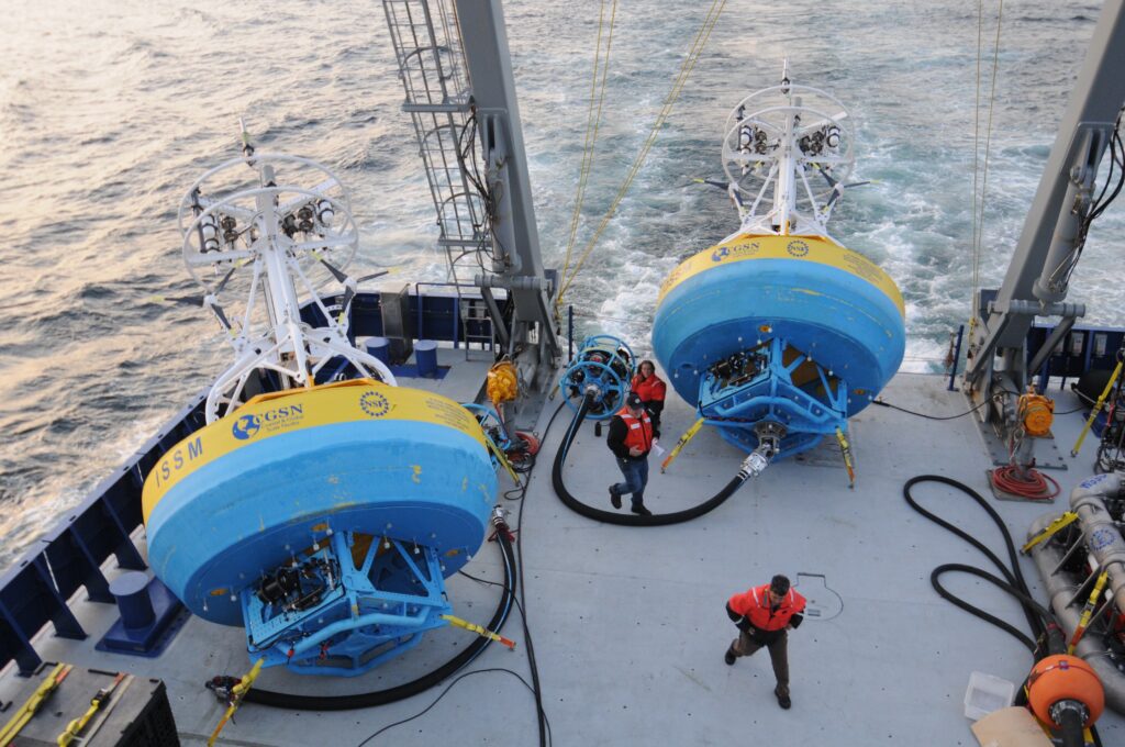
A major U.S. ocean monitoring system is being dismantled after federal funding cuts, threatening to erase one of the most valuable real-time climate and ocean data records in the country. Scientists are preparing to remove a research buoy from deep in the Pacific off the Oregon coast, beginning the shutdown of a large part of the Ocean Observatories Initiative, one of the most ambitious ocean-monitoring networks ever built.
The network includes more than 900 ocean sensors and cost about $386 million to build. It has collected continuous real-time data for more than a decade, tracking ocean circulation, marine ecosystems, climate change, and extreme weather. Its data has been freely available to researchers and has contributed to more than 500 scientific publications. The project had been expected to continue for another 15 to 20 years, but the National Science Foundation announced it would dismantle most of the system by 2027, removing instruments from waters off Oregon, Washington, Alaska, North Carolina, and Greenland.
The National Science Foundation described the move not as a cancellation, but as a “descoping” meant to support a more flexible approach to scientific priorities and research infrastructure. The agency said its decision drew partly on a 2025 National Academies report on the future of ocean science. But many scientists who built and used the system see the decision as a major setback, especially because long-term ocean data becomes more valuable the longer it continues.
The timing is particularly troubling. El Niño event is expected along the Pacific coast this summer, a pattern that can disrupt weather and intensify marine heat waves. One marine heat wave is already bringing unusually warm water off California. Scientists say losing the Oregon and Washington moorings, along with underwater gliders, will sharply reduce their ability to measure what is happening beneath the surface — where some of the most important ocean signals occur.
Ed Dever, an Oregon State University professor involved in the Pacific Northwest operations, called it a “crippling loss of information.” Satellites can measure surface conditions such as temperature and chlorophyll distribution, but they cannot capture many crucial underwater changes, including low-oxygen zones. That matters because subsurface data helps researchers understand ocean health, fisheries, climate signals, and extreme weather development.
The loss is also scientific because the project was designed to run for 25 to 30 years. Oceanographers often need at least three decades of continuous data to detect meaningful climate trends. The initiative has only reached about 10 years of records, enough to provide important clues but not enough to fully capture long-term change. One seafloor cable network managed by the University of Washington will remain, continuing to monitor volcanic and seismic activity in the Pacific Northwest, but much of the broader ocean-observing system will disappear.
The shutdown is part of a wider funding squeeze. The administration’s proposed 2026 budget included a 55% cut to the National Science Foundation. The Ocean Observatories Initiative operated on about $48 million a year, not including expensive research vessel costs, and supported around 60 to 70 workers across partner institutions before earlier budget cuts began.
Overall, the shutdown represents more than the loss of equipment. It weakens America’s ability to track climate change, marine heat waves, ocean oxygen levels, ecosystems, and extreme weather at a moment when those signals are becoming more urgent. For scientists, the concern is that a rare, expensive, and carefully built climate record is being interrupted just when the world needs it most.